FGA RCN - Property Price Register
The project
The geodetic authorities of Bosnia and Herzegovina needed a web app for the pilot project of the property price register. The main functionality was for gathering data in the field using tablet devices and storing them on internal servers.
It turned into much more. The end product was a multipurpose web app that allows the users to create as many database structures as they would wish and store spatial data directly represented on both orthophoto images and maps.

Data import
Considering that the pilot project already had substantial data collected in the field, the app needed an import feature. Since some of the data had a spatial aspect to it, we have decided to create the import in both the GeoJSON and JSON format.
Flexible database structure
To cover all the possible field situations and future uses the app was created so that the administrators have absolute freedom when creating the database structure, from tables, their relations to user permissions and validation of entered data.
157 Commits
200+ Cafes
5000+ Songs
27000+ Entries
User management
The property register allows flexible user creation with the option to limit the permissions of each user per role and project. There are three main roles: Administrator, Moderator and Operator.
Each of these roles acts as supervision and defines the permission of the roles below.
Project creation and flow
Data entry was conducted one area at a time. To avoid overlapping each area was a separate project. They are created selecting an option and by drawing a coverage polygon on the map.
Project specific user permissions were defined in order to assign responsibility and ensure a systematic approach.

Entery of spatial data
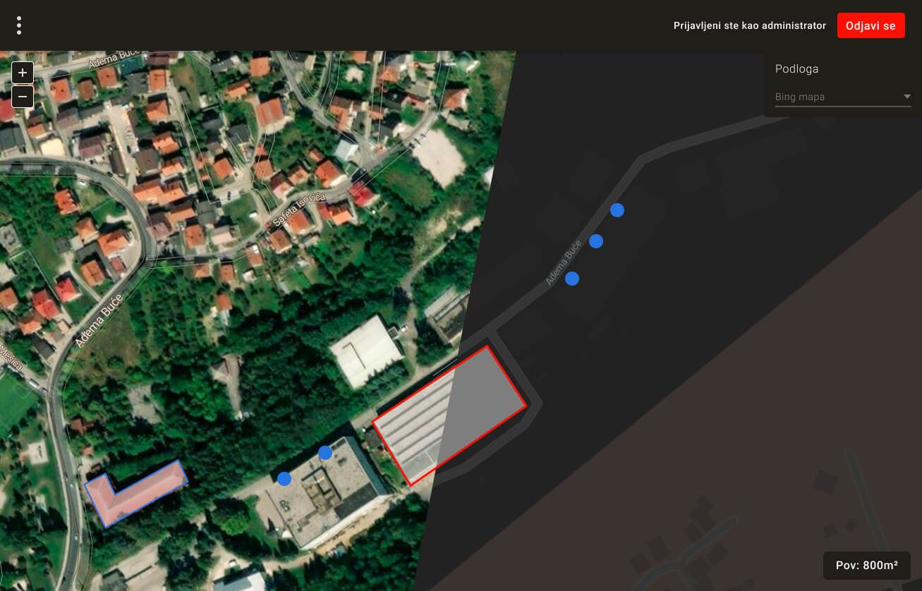
Spatial data for the property price register needed to be entered though tablets on the field. The app allows the operators to enter it as polygons or dots drawn on the map or areal images.
Polygons, created by defining vertices through a touchscreen, are used for land and private property and also provide information on the size of the area in square meters. Points represented real estate such as apartment buildings, where more units can be added to a single structure.
Some additional features include:
The app has the option to have images uploaded and attached to each entry for data verification purposes.
Entries can be filtered based on any field by activating the corresponding checkbox within the table.
Each field can be customized with its own set of validation rules and error messages.
Collected data can be easily exported in a format suitable for importing into the national cadaster.
Entry states and notifications
Data processing was conducted in three phases, each performed by different user groups. Entries, having three possible states, needed the option to switch states due to possible errors or changes in the field.
To ensure a clear overview and avoid disruptions in the process, spatial representations of entries are colour coded depending on their state, each entry can switch states with a click of a button and clear notifications are sent to the appropriate user. Everything is conducted in real-time.
Let's build something great together!
We approach projects one at a time with a first come first served attitude allowing us to fully focus our resources on your needs. Hire your dedicated team today.